Exploring Montana’s Landscape Transformations Through Interactive Maps and Hidden Gems Discovered with Google Earth
Over the last 70 years, Montana has experienced significant transformations, with population growth and landscape changes taking place in towns, cities, and surrounding areas. These changes have been subtle and dramatic, ranging from new stores and schools to complete overhauls of entire neighborhoods.
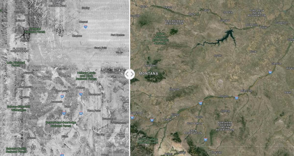
The Landscape Explorer project, a collaboration between the University of Montana, Working Lands For Wildlife, Montana NRCS, and Intermountain West Joint Venture, provides an interactive map that compares early satellite images from 1950 with more recent images. This tool showcases the drastic changes that have occurred in the western United States over the years and offers insight into how landscapes have evolved.
Users can explore the website’s map to gain a broader perspective on changes in the west or zoom in on their own neighborhoods to see transformations up close. The detailed view of Montana and surrounding states serves as an educational resource for those interested in learning more about how our world has changed over time.
In addition to using tools like the Landscape Explorer to explore landscape changes, individuals can also test their knowledge by identifying Montana lakes from Google Earth images. From underground caves to secret gardens, there are countless hidden gems waiting to be discovered throughout the United States. Whether you’re an outdoor enthusiast or simply someone who loves exploring new places, this diverse and beautiful country is sure to provide endless opportunities for adventure.

